Niterói, Rio de Janeiro, Brazil
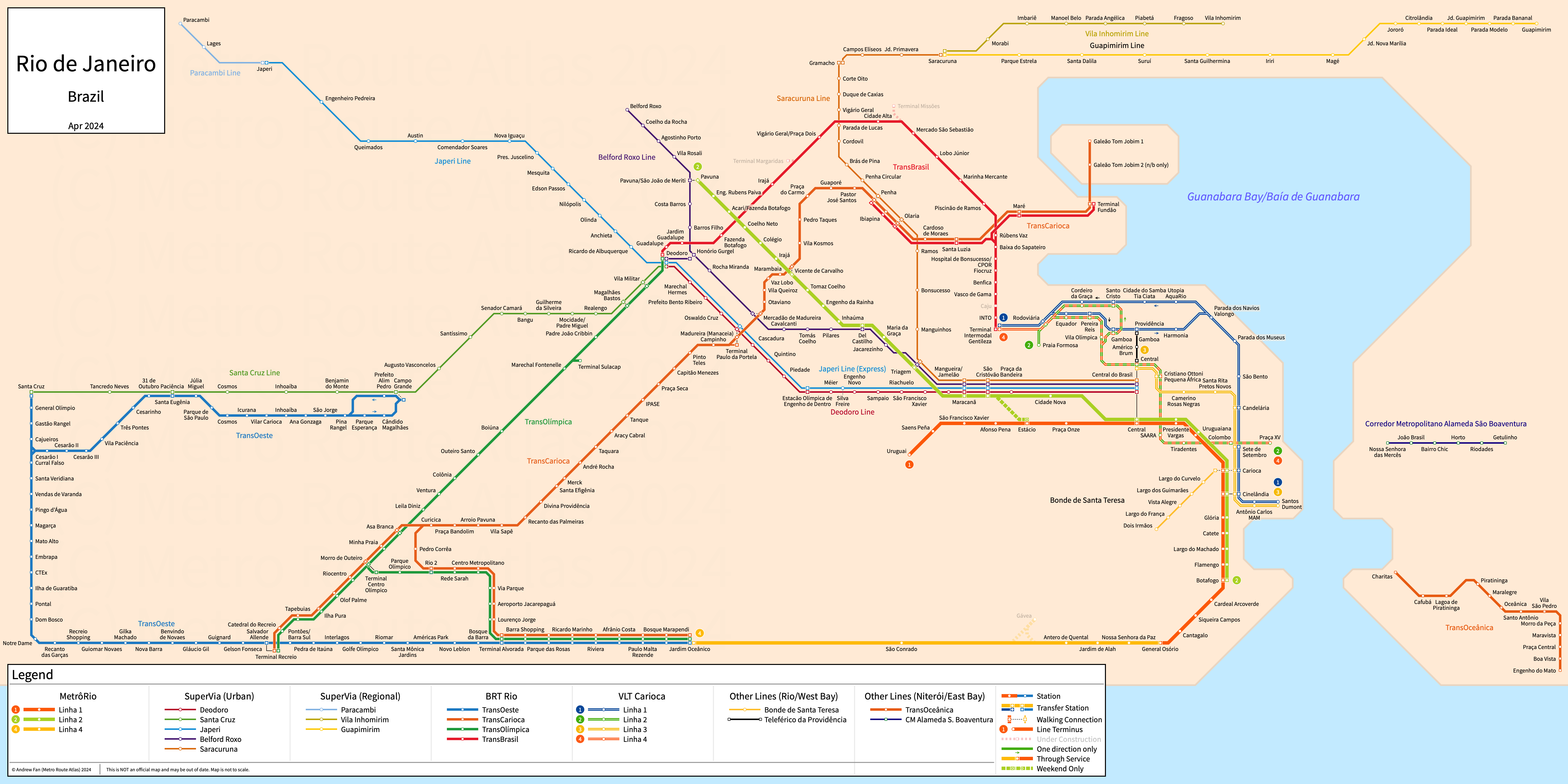
Table of Contents
Overview - Niterói
Located on the east side of Guanabara Bay across from Rio, Niterói is a city in the State of Rio de Janeiro. It has approximately 482,000 inhabitants in the city proper as of 2022. It is counted as part of the Rio metropolitan area.
Niterói's rapid transit network consists of a bus rapid transit line. It also has two BRT-Lite lines.
TransOceânica
TransOceânica
TransOceânica is a bus rapid transit line on an East-West alignment. It runs from the Charitas ferry terminal in the west to Engenho do Mato in the east, serving 13 stations.
TransOceânica was opened in 2019.
Corredor Metropolitano
Niterói's BRT-Lite network consists of two BRT-Lite lines serving the city of Niterói.
Alameda São Boaventura
Corredor Metropolitano Alameda São Boaventura is a BRT-Lite line on an East-West alignment. It runs from Nossa Senhora das Mercês in the west to Getulinho in the east, serving 6 stations.
Corredor Metropolitano Alameda São Boaventura was opened in 2010.
Av. Visconde do Rio Branco
The Corredor de Mobilidade Urbana Av. Visconde do Rio Branco is a BRT-Lite line on a North-South alignment. It serves 3 stations.
Corredor de Mobilidade Urbana Av. Visconde do Rio Branco was opened in 2025.
References & Helpful Links
Official Website for TransOceânica: TransOceânica
Maps
Other Sources
Niterói, Brazil at BRTDATA.org
Other Websites
External Citations
Asset Notes
TransOceânica color taken from logo as of February 2022. CM Alameda São Boaventura color taken from Official Website strip map as of February 2022.