Gold Coast, Queensland, Australia
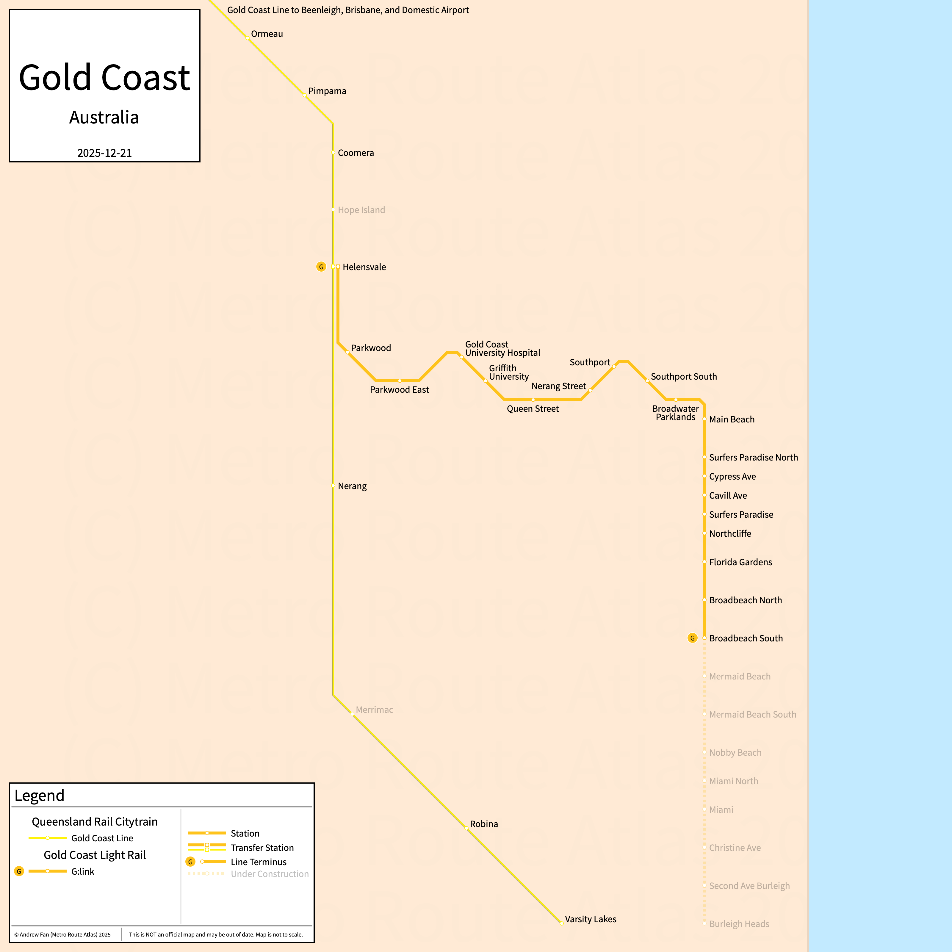
Table of Contents
Overview - Gold Coast
Located south of Brisbane at the New South Wales border, the Gold Coast is the second largest city by population in Queensland. It has approximately 625,000 inhabitants in the city proper as of 2021. The Gold Coast metropolitan area (Gold Coast-Tweed Heads SUA) comprised 693,596 residents as of the 2021 Australian Bureau of Statistics Estimate.
Gold Coast's rapid transit network consists of a light rail line. It also has a regional rail service.
Gold Coast Light Rail
Opened July 2014, the Gold Coast Light Rail, or G:link, consists of a light rail service that serves the city of the Gold Coast, Queensland and the surrounding suburbs.
Gold Coast Light Rail
The Gold Coast Light Rail is a light rail service on a north-south alignment. It runs from Helensvale in the north to Broadbeach South in the south, serving 19 stations.
The Gold Coast Light Rail was opened in July 2014 and the last extension to the line was to Broadbeach South in December 2017. The Gold Coast Light Rail is owned by Translink.
| Service | M-F Midday | M-F Rush | Sat. | Sun. | Notes |
|---|---|---|---|---|---|
| G:link | 7.5' | 7.5' | 10' | 10' |
Schedules -- Last Updated: Dec 13, 2025
Queensland Rail Citytrain
Within the Gold Coast area, Queensland Rail's Citytrain network, operated by Translink, consists of a regional rail line. For more information, see the Brisbane page.
References & Helpful Links
Railways in South East Queensland at Wikipedia
Official Website for Gold Coast Light Rail: G:link
Official Website for Queensland Rail Citytrain: Translink
Maps
All Official Maps - Translink [Last Accessed December 12, 2025]
Official System Map - Translink [PDF] [Last Accessed December 12, 2025]
Other Sources
Gold Coast, Australia at Urbanrail.net
Other Websites
External Citations
Asset Notes
The Gold Coast Light Rail colors were taken from the official website logo as of December 12, 2025.