Mississauga-Brampton, Ontario, Canada
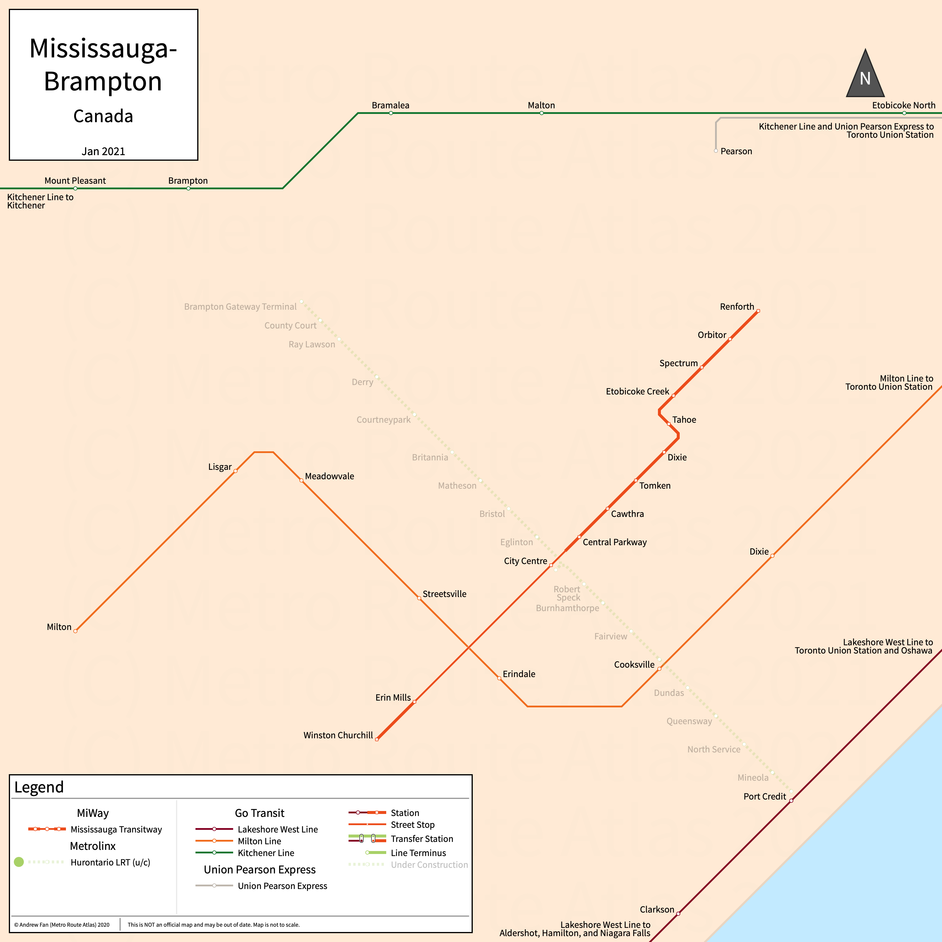
Table of Contents
Overview - Mississauga-Brampton
Located west of Toronto on Lake Ontario, Mississauga is the third largest city by population in Ontario. It has approximately 772,000 inhabitants in the city proper as of 2022. To the north, Brampton is the seat of the Regional Municipality of Peel. It has approximately 746,000 inhabitants in the city proper as of 2023.
Mississauga-Brampton's rapid transit network consists of a bus rapid transit open busway. It also has three commuter rail services and a number of rapid bus services (not covered on this site).
Mississauga Transitway
Mississauga Transitway
The Mississauga Transitway is a bus rapid transit open busway on an East-West alignment. It runs from Winston Churchill in the west to Renforth in the east via Mississauga City Center, serving 12 stations. Note that as an open busway, most services only serve a portion of the corridor.
The Mississauga Transitway was opened in November 2014 and the last extension to the line was in November 2017 to Renforth. The Mississauga Transitway is operated by GO Transit and MiWay.
GO
For information on GO, refer to the Toronto page.
References & Helpful Links
Mississauga Transitway at Wikipedia
Official Website for Mississauga Transitway: MiWay
Official Website for GO: GO
Maps
All Official Maps - GO Transit [Last Accessed Feb 15, 2026]
Official System Map - GO Transit [PDF] [Last Accessed Feb 15, 2026]
Other Sources
Mississauga, Canada at BRTDATA.org
Asset Notes
Mississauga Transitway color taken from official MiWay logo as of December 2020
GO Commuter Rail line colors taken from official GO map as of November 2020. GO Color taken from GO DRM. UP Express color taken from official GO map as of April 2024.