006 Avonby Transit, OpenTTD
Table of Contents
Overview - 006 Avonby Transit
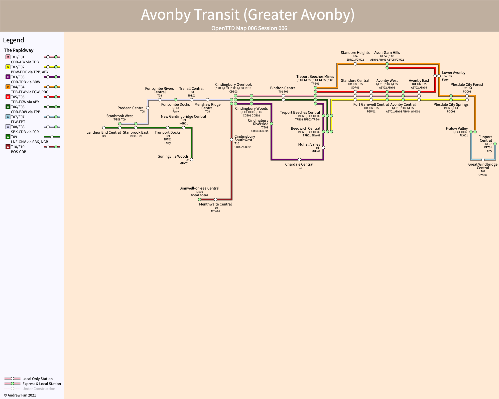
Welcome to the Greater Avonby region! In Greater Avonby, rapid transit is provided exclusively by buses. The Rapidway consists of 44 trunk services comprising local-express pairs, as well as countless feeder services serving towns and cities and connecting to The Rapidway.
The Rapidway is built specially for high, uninterrupted passenger flows. Due to limitations in OpenTTD whereby vehicles cannot pass on one directional roads, The Rapidway uses large stations, and fully segregates local and express services not only from all other roads but also from one another. At standard Rapidway stations, it is possible for 12 local and 12 buses in each direction to berth simultaneously, and with up to three service pairs per station (not including hub stations and transfer stations), you can travel anywhere with ease.
From its humble beginnings as a single trunk line connecting Avonby and Cindingbury, The Rapidway has grown to connect many different towns and cities to one another. Boasting a fleet of over 2700 vehicles on Rapidway services and over 900 more on feeder services, excellent service is provided no matter where you are.
Regions Served
Regions served by The Rapidway are in order of expansion. They are Greater Avonby, Treport Beeches-Cindingbury, FFF, Western Partition, Gedean-Accstoke, and the Southwest Villages.
Greater Avonby
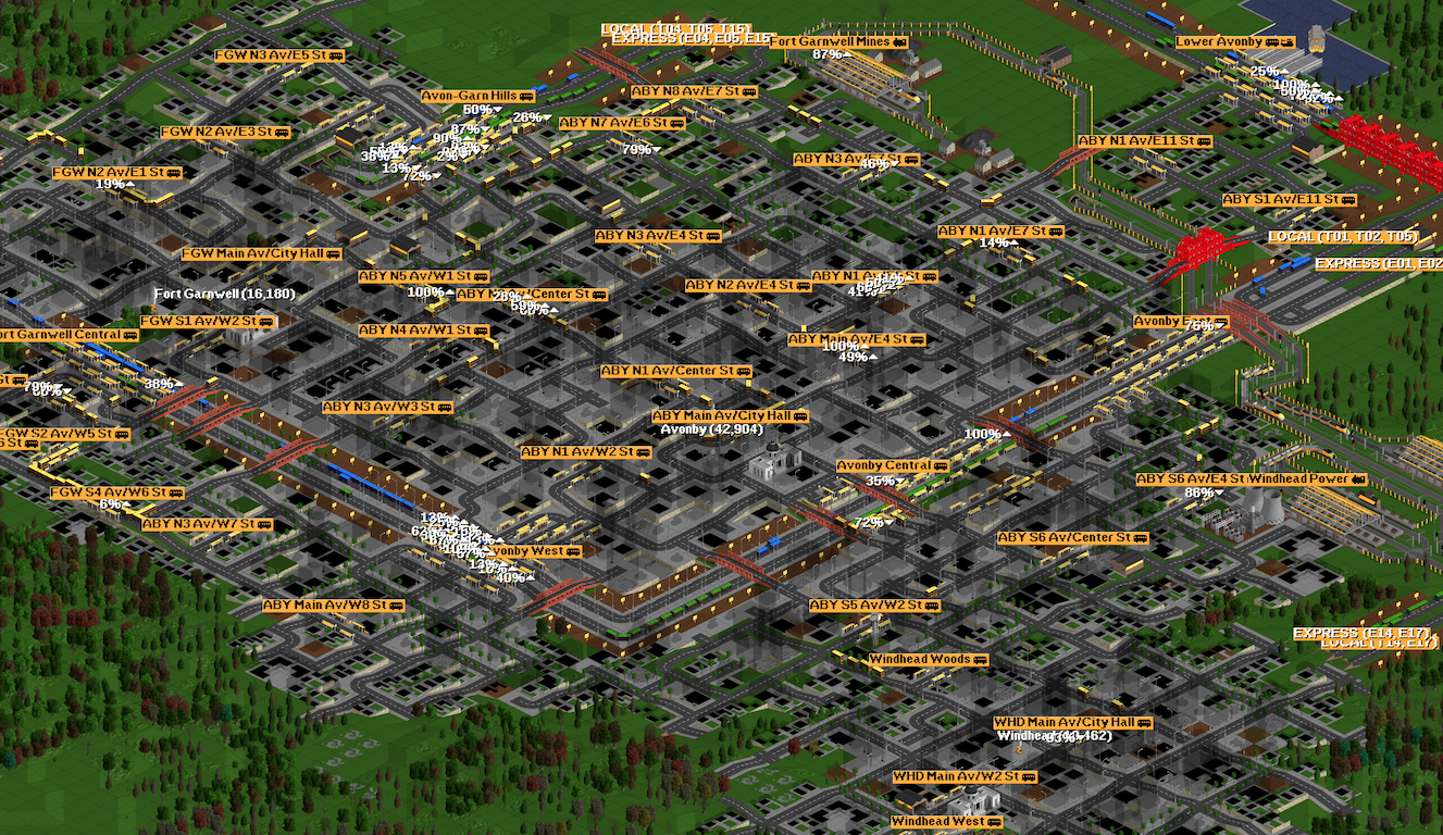
Avonby today. Western part not shown. [A] Avonby-Cindingbury Trunk Line in the middle of the image, with the [B] First Relief Trunk Line at the top and top right and [J] Second Relief Trunk Line in the bottom right.
The first metropolitan area served was Greater Avonby's core, comprising the City of Avonby, as well as the towns of Fort Garnwell and Standore. Early in The Rapidway's life, high usage of the [A] Avonby-Cindingbury Trunk Line resulted in a new line being built around the northern part of the area - [B] First Relief Trunk Line. While this area now is considerably less important, recent expansions to the southeast resulted in the creation of a new hub at Avonby and the [J] Second Relief Trunk Line to the Treport Beeches-Cindingbury region.
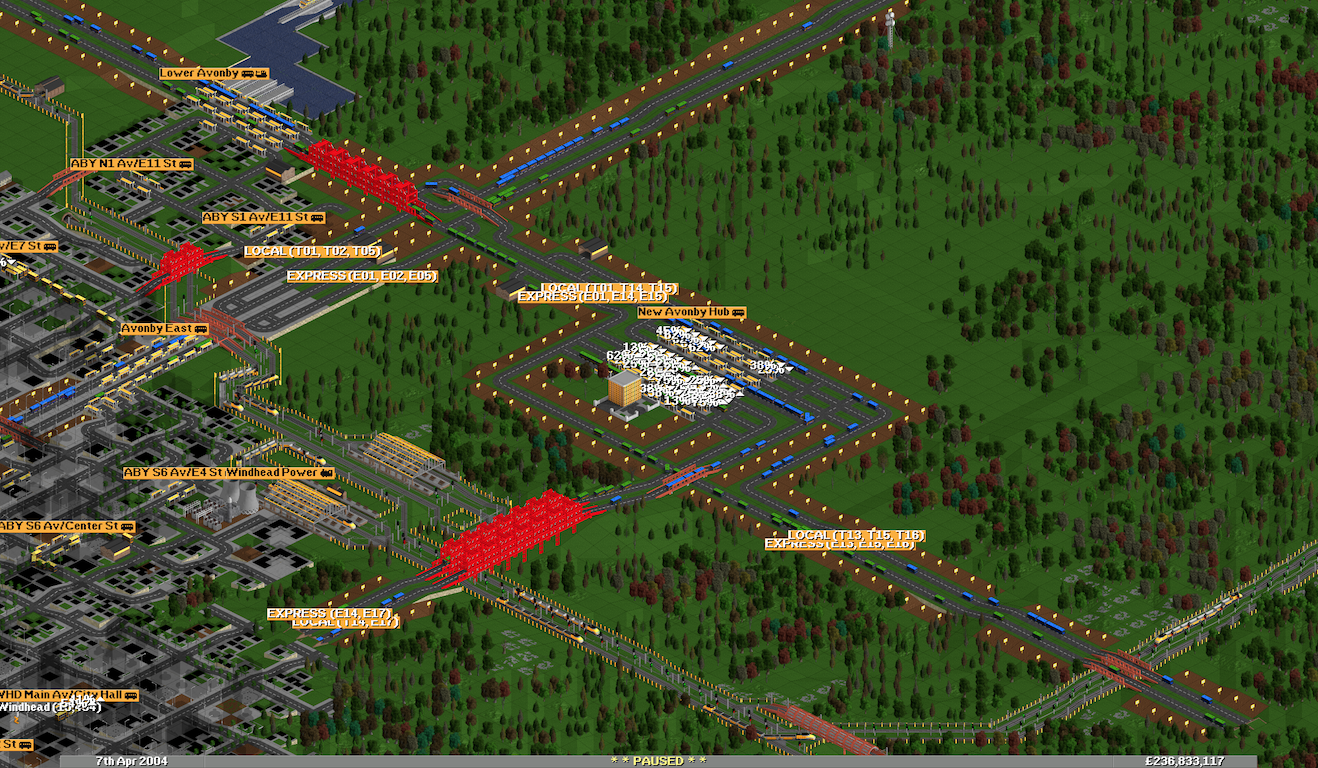
New Avonby Hub, connected to four separate trunk lines (A, B, I, J) and serving six service pairs. The largest single station in the network, with space for 144 simultaneous vehicles and with two bypass lanes to allow terminating services to exit without interfering with traffic coming in the other direction
Due to service six separate Rapidway service pairs, every station in the entire Rapidway network can be reached with a single transfer from New Avonby Hub, and although built on a greenfield site, it is a hub of considerable importance. In addition, after having operated out of a TheyWork in Avonby for a few decades, the construction of the New Avonby Hub was soon accompanied by the building of the Avonby Transit Headquarters.
Treport Beeches-Cindingbury
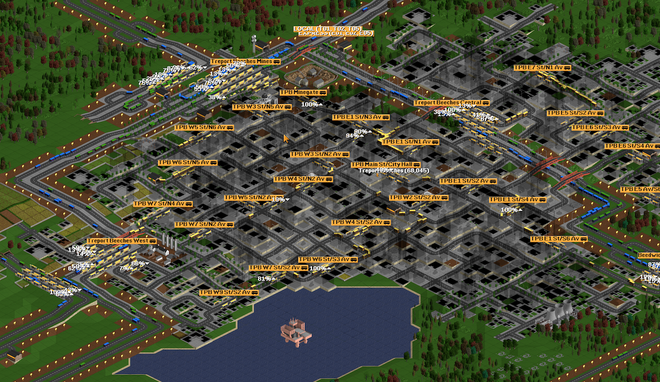
Treport Beeches today. Original two tunnels on [A] Avonby-Cindingbury are just to the north of the area shown, with [B] First Relief Trunk Line in the top left and [C] Loop Trunk Line on the right half of the image.
After the construction of the very first trunk in Greater Avonby, the construction of two major tunnels brought service to the Treport Beeches-Cindingbury region, currently the core of the entire network. As the two fastest growing cities, they have the most extensive feeder service of any cities in the network outside of Avonby itself.
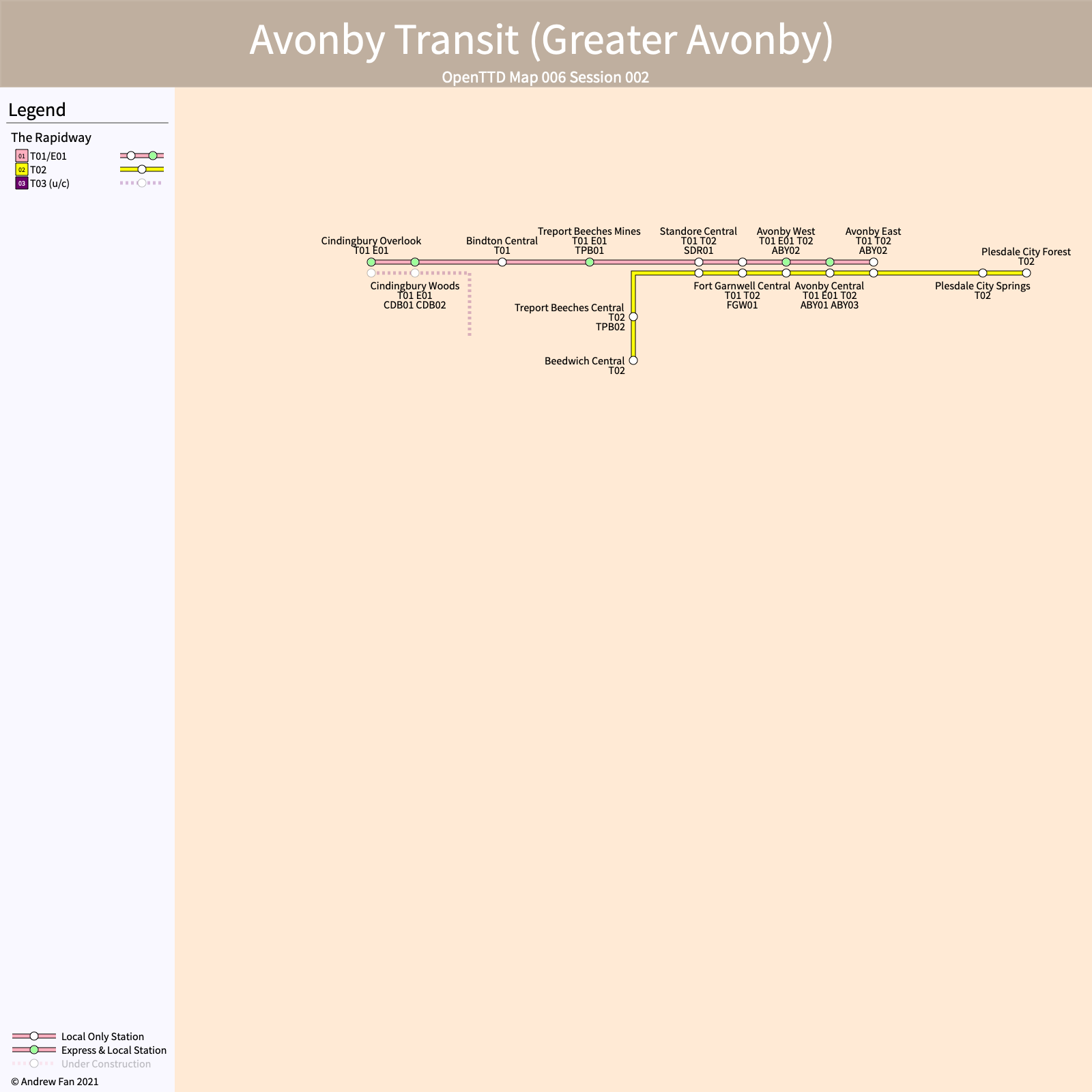
Network map after completion of the first trunk line ([A] Avonby-Cindingbury) between Plesdale City Forest and Cindingbury Overlook. The trunk has since been extended to two further destinations in the east, and the T/E02 portion to Beedwich Central is now the most congested part of the [C] Loop Trunk Line.
Treport Beeches Mine was originally built on the outskirts due to inefficiencies that would have resulted in a closer alignment to the city. However, this distance allowed for two major upgrades - first, the ability to expand it to four platforms to allow it to serve as a terminus as well as a through station, and secondly the space to add another set of platforms for the [B] First Relief Trunk Line. Notably, once the [A] Avonby-Cindingbury Trunk Line was finally conceived and constructed, it was determined that the T/E01 service pair was too long, and so two short-turn routes that had been put into place just prior were renamed to T/E05 and T/E06 and were routed to other termini. These ended up becoming key connector lines removing the need for transfers.
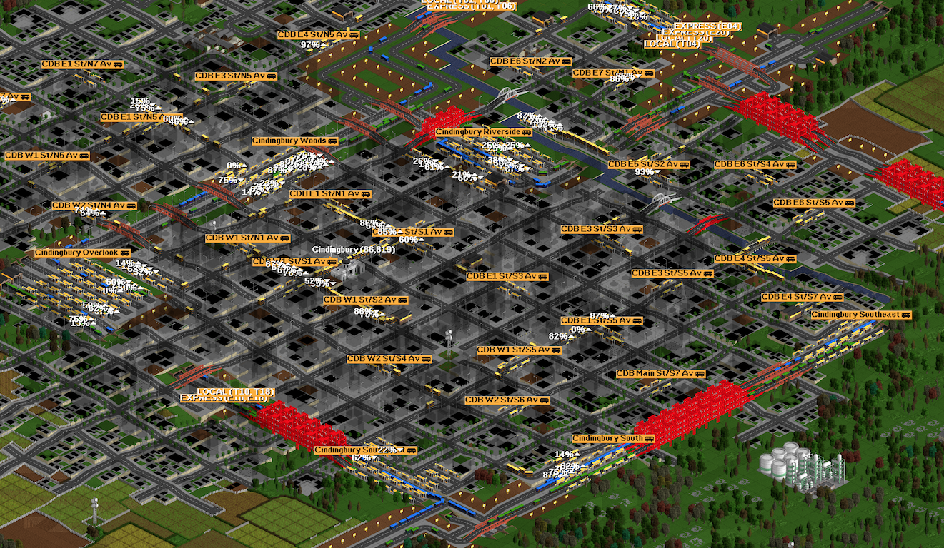
Cindingbury today. Bindton East (name of station not shown) in the north is a new feature added much later as part of expansion of the [B] First Relief Trunk Line to Cindingbury. Coincidentally, it has also reached capacity.
Cindingbury has undergone rapid expansion, from the original [A] Avonby-Cindingbury Trunk Line to the completion of the [C] Loop Trunk Line, the opening of the [E] West Trunk Line and [G] South Trunk Line, and the closure of a loop around the city as part of the [K] Cindingbury Bypass Line. In hindsight, leveling the top of a hill to build a massive hub at Cindingbury Overpass proved an excellent decision as it allowed for multiple services to terminate and offer transfers. Once the [K] Cindingbury Bypass Line opened, two additional platforms were opened at Cindingbury Riverside, and later on the [B] First Relief Trunk Line was extended - in order to ensure pathfinding didn't mess up at the junction, Bindtown East became an express station - it ended up needing to be given the passenger loads it handles.
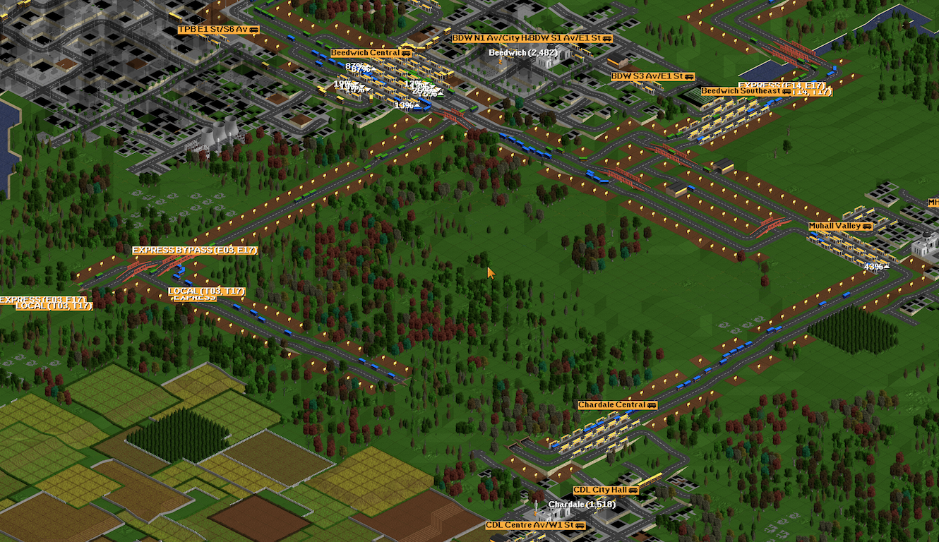
The core portion of the [C] Loop Trunk Line, consisting of local only service to Muhall and Chardale and an express bypass line that ignores the two towns entirely
Between Treport Beeches and Cindingbury lie a few smaller towns. While Beedwich Central became a massive terminus and hub due to necessity (part of it was eventually demolished and expanded to four platforms), Muhall and Chardale remain quiet towns except for the transfer backlog at Muhall exceeding the town's population by 10x ever since the opening of the [J] Second Relief Trunk Line turned it into a transfer station.
FFF
FFF Region. While T/E07 was the original service and the expansion here was long planned, construction of the western partition took precedence, with three western routes being built prior to the eastern routes being completed. The main components here are the [D] East Trunk Line, built in two phases as mentioned prior, and the southern connector for the [I] HubLink Trunk Line opened as part of the dual hubs later on.
Extension of the original [A] Avonby-Cindingbury Trunk Line to Plesdale City resulted in weak ridership and the increasing network complexity led to the development of a split network at Fralow Valley - the same as what was done at Cindingbury Overlook. In the end, the partitioning was moot because the entire network was linked anyways, but the early segregation of services left an interesting relic - T/E07, which was one of the weaker trunk lines at the time of creation but which, due to the number of feeders, quickly overloaded the transfer point to T/E04 at Fralow Valley.
It was not until much later that the remainder of the [D] East Trunk Line was built, at which point this transfer point got even more overloaded, resulting in the plan for a direct link to the [B] First Relief Trunk Line from the eastern areas. This opened much later but Fralow Valley remains overloaded to this day.
Western Partition
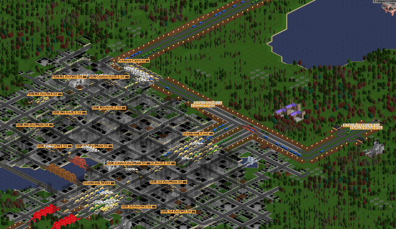
Stanbrook, the location of the first major ROW breach and one of the most overbuilt trunk areas in the entire map. Routes T/E08 along the [E] West Trunk Line remain the only routes that are capable of running at full capacity as an independent route for their entire length without interlining.
From Cindingbury Overlook, Stanbrook was the next major destination. Once there, I decided to do something interesting - build both city stations with double the size, in order to enable much higher traffic loads. These loads never materialized, and actually resulted in awful bus bunching on T09 since there was ample capacity and no additional lines forcing breaks between buses on those services. In addition, when T09 along the [F] Southwest Trunk Line was built, it was initially judged that the distance between Goningville and Cindingbury Overlook did not justify its own line. As a result, T09 acted as a feeder to T/E08 for a good while, overloading it and forcing it to be used for far more capacity than intended. In addition, due to a ferry link between Trunport Docks and Funcombe Docks, the plan to run a service between the two never materialized as it would have bypassed Stanbrook.
Map as of the opening of the [E] West Trunk Line, [F] Southwest Trunk Line, and [G] South Trunk Line, all operated as the Western Partition.
Notably, T09, until the opening of the first stage of the [K] Cindingbury Bypass Line, was the only service to only operate local, with no express service of any kind. As for T/E10, it was heavily tunneled to the point where when I wanted to build the [K] Cindingbury Bypass Line, service had to be temporarily suspended for the main tunnel to be shortened to enable a junction. See the image of Cindingbury for the junction.
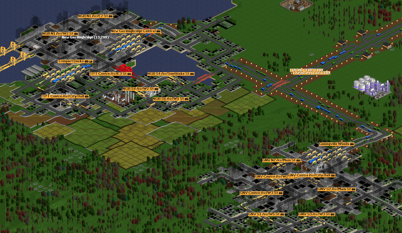
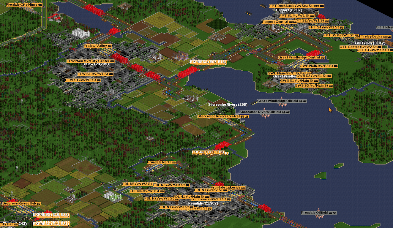
Trunport and Goningville on the [F] Southwest Trunk Line. It was originally not planned to connect these to the [G] South Trunk Line.
Eventually, load on T/E08 and T/E10 rose to the point where it was no longer acceptable to keep them separate, and the [K] Cindingbury Bypass Line was built, significantly decongesting the two. At this point, express services were introduced, and New Gardingbridge Central became the first city central station to become a local only station, due to all the transfers on the ferries going to Trunport Docks instead.
Gedean-Accstoke
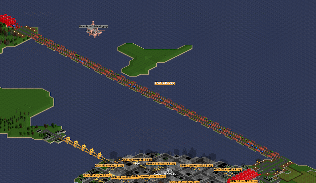
The Girderway, a key feature of the link between the FFF area and Gedean. As a key portion of the [D] East Trunk Line, it suffered from severe overcrowding until the T/E22 reliever service was added later.
Once the Western Partition was built, the Eastern Partition was built, with Accstoke Woods as its main core. Originally, the plan was to build the [L] Southwest Villages Trunk Line quickly and send it to Malcombe. In the meantime, T/E12 was built to serve Malcombe and immediately became the line losing the most money on the entire network due to Malcombe's poor geography.
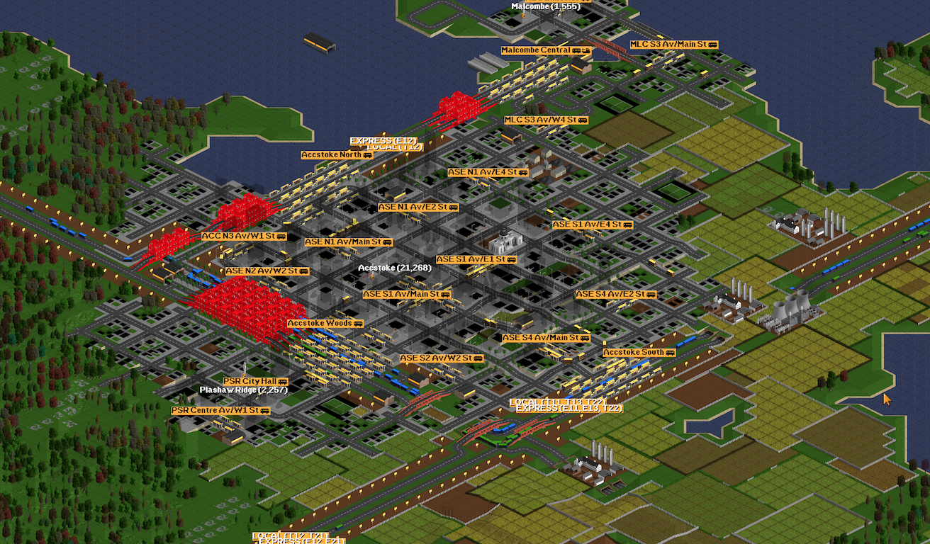
Accstoke, one of the main hubs in the Eastern Partition, and the junction of the D, H, I, and L trunk lines.
Eventually though, forcing everything along the East Trunk Line became unsustainable, and the stub line built north of Accstoke was completed through New Avonby Hub as the [I] HubLink Trunk Line (the Shorcombe Woods connector and T/E16 portion was actually built first but saw service start later). The three hubs along this route carry significant passenger loads and are now the main gateway to the rest of the network, with the [J] Second Relief Trunk Line being built immediately after in order to manager the load. Notably, the intention was to run services through to the [B] First Relief Trunk Line and [J] Second Relief Trunk Line directly, but it was determined that the New Avonby Hub was necessary in order to enable transfers to the [A] Avonby-Cindingbury Trunk Line. The Raningdon Green Branch was added at this time in order to provide an alternate eastern terminus besides Plesdale City Forest.
Southwest Villages
The Southwest Villages were the last areas to gain service, and although the [L] Southwest Villages Trunk Line was long, it linked into the existing network seamlessly. There wasn't much time for this area to grow, and so there isn't much to be said here outside of the fact that it was able to use modern, long bridges at high speeds.
Trunk Lines and Services
The Rapidway is divided into a number of Trunk Lines and Services, though the Services are the primary identifiers.
Trunk Lines, in order of first segment opening, are as follows:
- [A] Avonby-Cindingbury Trunk Line (& Raningdon Green Branch Line): Cindingbury Overlook to New Avonby Hub, Fralow Valley, and Raningdon Green Heights via Treport Beeches Mines and Avonby Central
- [B] First Relief Trunk Line: Bindton East to junction with [A] south of Lower Avonby via Treport Beeches Mines and Avon-Garn Hills
- [C] Loop Trunk Line: Junction with [A] north of Cindingbury Riverside to junction with [A] north of Treport Beeches Central via Beedwich Central
- [D] East Trunk Line (& Funport Branch Line): Fralow Valley to Funport Central and Accstoke South via Gedean South
- [E] West Trunk Line: Stanbrook West to Cindingbury Overlook via Funcombe Docks
- [F] Southwest Trunk Line: Old Satchester Falls to Goningville Woods via Stanbrook
- [G] South Trunk Line: Binnwell-on-sea Central to Cindingbury Overlook
- [H] Malcombe Branch Line: Accstoke Woods to Malcombe Central
- [I] HubLink Trunk Line: Accstoke Woods and junction with [D] east of Frundale North to junction with [A] via Sudgrove Rivers Hub and New Avonby Hub
- [J] Avonby Glider (Second Relief Trunk Line): Junction with [C] west of Beedwich Southwest to New Avonby Hub
- [K] Cindingbury Bypass Line: Junction with [F] to Bindton East and junction with [C]
- [L] Southwest Villages Trunk Line: Frudfield Valley to Accstoke Woods via Meaworth-Fadean
As for the services, there are 22 service pairs running across lines, each with a local and express component which run the same route but in separate right of ways. Expresses only stop at certain locations with high ridership.
Design Methodology
Going into this project, I decided immediately to ban tramways, railroads for passengers, and air travel of any kind. Fresh off of the Colombia research on the MRA, I debated what kind of system to run, what kind of junctions I wanted, and... all of it burned in flame when I did my first proof of concept. OpenTTD was not built for bus rapid transit.
First and foremost, buses can never pass one another unless one is of a faster model. In addition, they cannot use both sides of a one way street, including the stations. This is available in a patch pack but I was running vanilla OpenTTD. Finally, if buses are stopping, buses behind also stop and cannot go around. All of these factors killed all possibility of express services doing anything similar to TransMilenio, stopping at specified stations that other services passed. This also meant that if I wanted reliable passing, I had to either run express services contraflow on the same lane (very very very limiting) or completely segregate local and express services. I did the latter and it worked like a charm, with one problem - towns can build roads, and if a town built a road connecting the local and express roadways, the pathing would mix the two - something that would cause immense damage to the network. This actually occurred twice - the first time a local bus rerouted to a feeder station, and the second time the local and expresses mixed and forced a rollback of three autosaves. The fix was to purchase all land around the right of way that could potentially result in a road connection - this had to be done manually tile by tile and was an immense pain and source of impending panic, with a mine at the Treport Beeches junction poised to corrupt the entire network at the main junction should it disappear without my knowing.
In the end, I still had a decent system. I paired local and express service routes for my own sanity and ease of legibility, and designated stations as local only or local and express. It didn't matter which service pair an express service belonged to - all expresses stopped or none stopped. Copious use of non-stop orders on express services allowed all buses to bypass stations while still allowing the catchment area of the express station to be used. Unfortunately, as mentioned before, OpenTTD was not built for bus rapid transit. Bus bunching could only be managed by interlining and forcing buses to mix (timetabling would have reduced capacity by forcing unnecessary waits), and I was running so many vehicles that the game lagged. I also started with a map four times the size it should have been, but running 3500+ vehicles was more significant.
As for feeder services, I assigned each town a three letter designation and used those. I put feeders pretty much anywhere I could or had the patience for. I think it worked fine.
In the end, I don't think I'll ever do a BRT only map ever again. Heavy interlining to prevent bunching is not a fantastic strategy, and the lag at the end of the map was severe. Buses also only go so fast, and are not suited for the distances and intercity nature of OpenTTD. If I do something similar, I'll do it with trams, which have a better passenger:vehicle ratio and do not suffer from the 'town will build guideway and corrupt your network' problem.