Newcastle, New South Wales, Australia
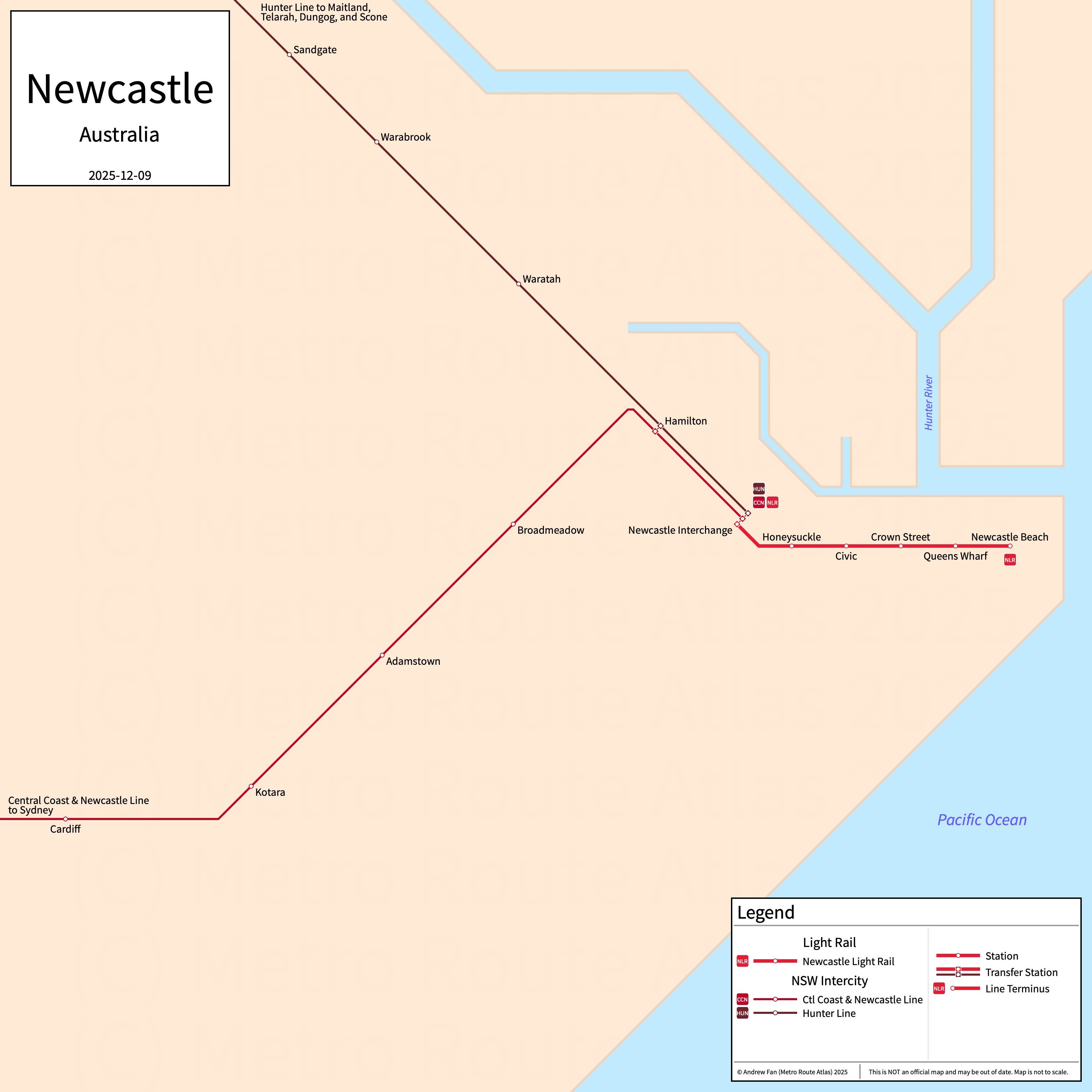
Table of Contents
Overview - Newcastle
Located on the Hunter River, Newcastle is the second largest city by population in 166,000 inhabitants in the city proper as of 2021. The Newcastle metropolitan area (Newcastle-Maitland SUA) comprised 508,437 residents as of the 2021 Australian Bureau of Statistics Estimate.
Newcastle's rapid transit network consists of a modern tram line. It also has a commuter rail service and an intercity rail service.
Newcastle Light Rail
Opened 2019, the Newcastle Light Rail consists of a modern tram service that serves the city of Newcastle, New South Wales.
Newcastle Light Rail
The Newcastle Light Rail is a modern tram service on an East-West alignment. It runs from Newcastle Interchange in the west to Newcastle Beach in the east along the old railway right of way, Hunter St, and Scott St, serving 6 stations.
The Newcastle Light Rail was opened in February 2019. The Newcastle Light Rail is operated by Newcastle Transport.
| Service | M-F Midday | M-F Rush | Sat. | Sun. | Notes |
|---|---|---|---|---|---|
| NLR | 7-8' | 7-8' | 15' | 15' |
Schedules -- Last Updated: Dec 09, 2025
New South Wales Intercity
The New South Wales Intercity network comprises two lines in the Newcastle area.
Central Coast and Newcastle Line
The Central Coast and Newcastle Line is an intercity rail line on a North-South alignment. It runs from Central in Sydney to Newcastle Interchange via Gosford along the Newcastle, Main North, and North Shore lines. All trains originating in Newcastle continue to Sydney.
The Central Coast and Newcastle Line is operated by Sydney Trains.
Hunter Line
The Hunter Line is a commuter rail line on an East-West alignment, running from Scone and Dungog to Newcastle Interchange via Telarah and Maitland along the Newcastle, Main North, and North Coast lines, serving 28 stations. Most services only go as far as Maitland or Telarah.
The Hunter Line is operated by Sydney Trains.
References & Helpful Links
Newcastle Light Rail at Wikipedia
Official Website for Newcastle Light Rail: Newcastle Transport
Official Website for NSW Intercity: Transport NSW
Maps
Official Line Map - Newcastle Light Rail [PDF] [Last Accessed December 09, 2025]
Official System Map - NSW Intercity [PDF] [Last Accessed December 09, 2025]
Other Sources
Newcastle, Australia at Urbanrail.net
Other Websites
External Citations
Asset Notes
All colors taken from the Transport from New South Wales website on December 9, 2025.