Uberaba, Minas Gerais, Brazil
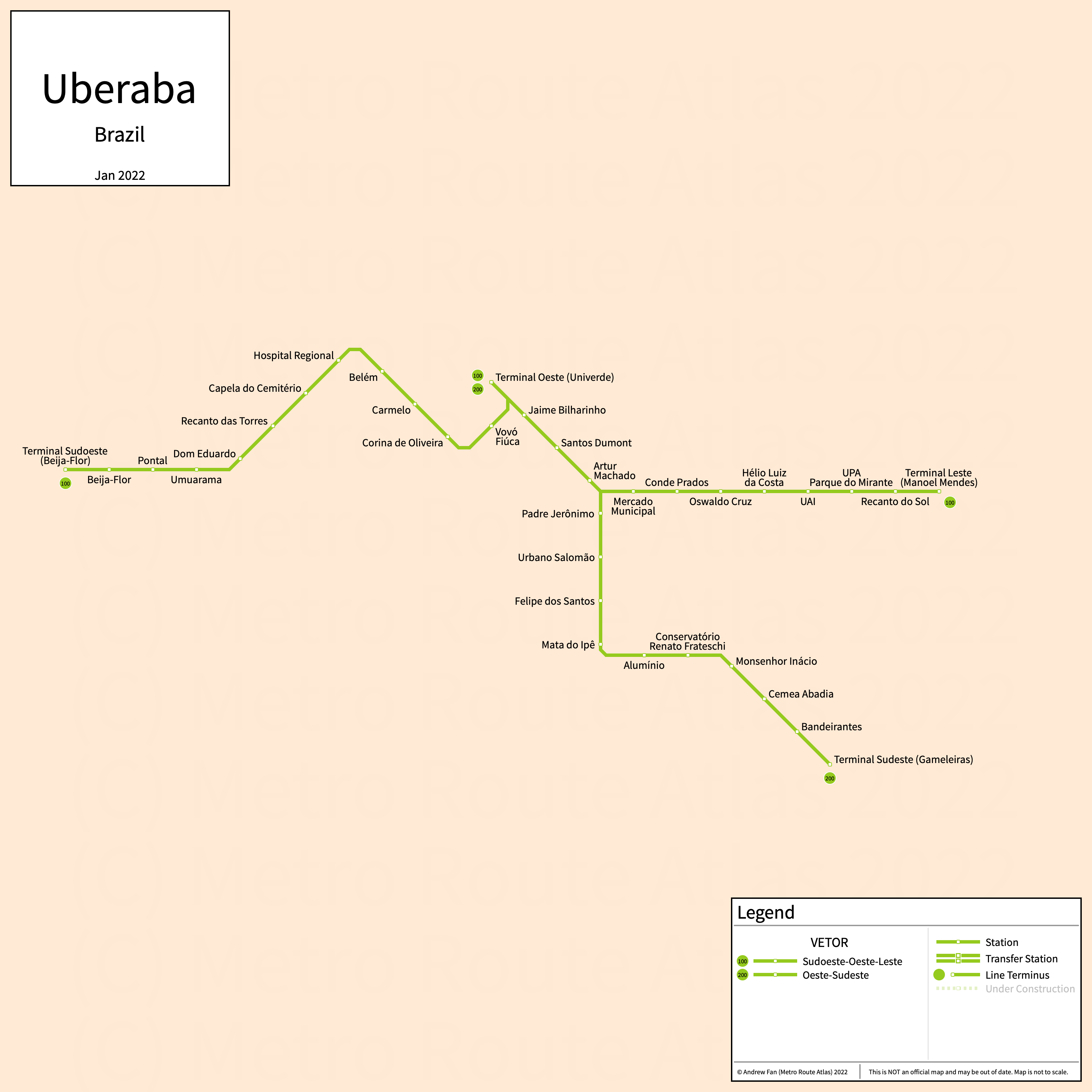
Table of Contents
Overview - Uberaba
Located in the Triângulo Mineiro, Uberaba is a city in Minas Gerais. It has approximately 338,000 inhabitants in the city proper as of 2022.
Uberaba's rapid transit network consists of three bus rapid transit lines. THe Uberaba metropolitan area comprised 337,836 residents as of the 2022 IGBE census estimate.
VETOR
Opened 2015, VETOR consists of three bus rapid transit lines that serve the city of Uberaba, Minas Gerais and the surrounding suburbs.
East-West (Leste-Oeste; Linha Verde)
VETOR's East-West Corridor is a bus rapid transit line on an East-West alignment. It runs from Terminal Oeste (Univerde) in the west to Terminal Leste (Manoel Mendes) in the east, serving 12 stations. The primary service is 100, with 200 serving through operations onto the Southeast Corridor.
The East-West Axis was opened in January 2015.
Southeast (Sudeste; Linha Laranja)
VETOR's Southeast Corridor is a bus rapid transit line on a L-shaped alignment. It runs from the East-West Corridor in the north to Terminal Sudeste (Gameleiras) in the southeast, serving 10 stations. The primary service is 200.
The Southeast Corridor was opened in August 2018.
Southwest (Sudoeste; Linha Azul)
VETOR's Southwest Corridor is a bus rapid transit line on an East-West alignment. It runs from Terminal Sudoeste (Beija-Flor) in the west to the East-West Corridor, where services through-operate to Terminal Oeste (Univerde) in the east, serving 12 stations. The primary service is 100.
The Southwest Corridor was opened in September 2018.
References & Helpful Links
Maps
Other Sources
Uberaba, Brazil at BRTDATA.org
Other Websites
External Citations
Asset Notes
VETOR Colors taken from 2017 VETOR guide.