Winnipeg, Manitoba, Canada
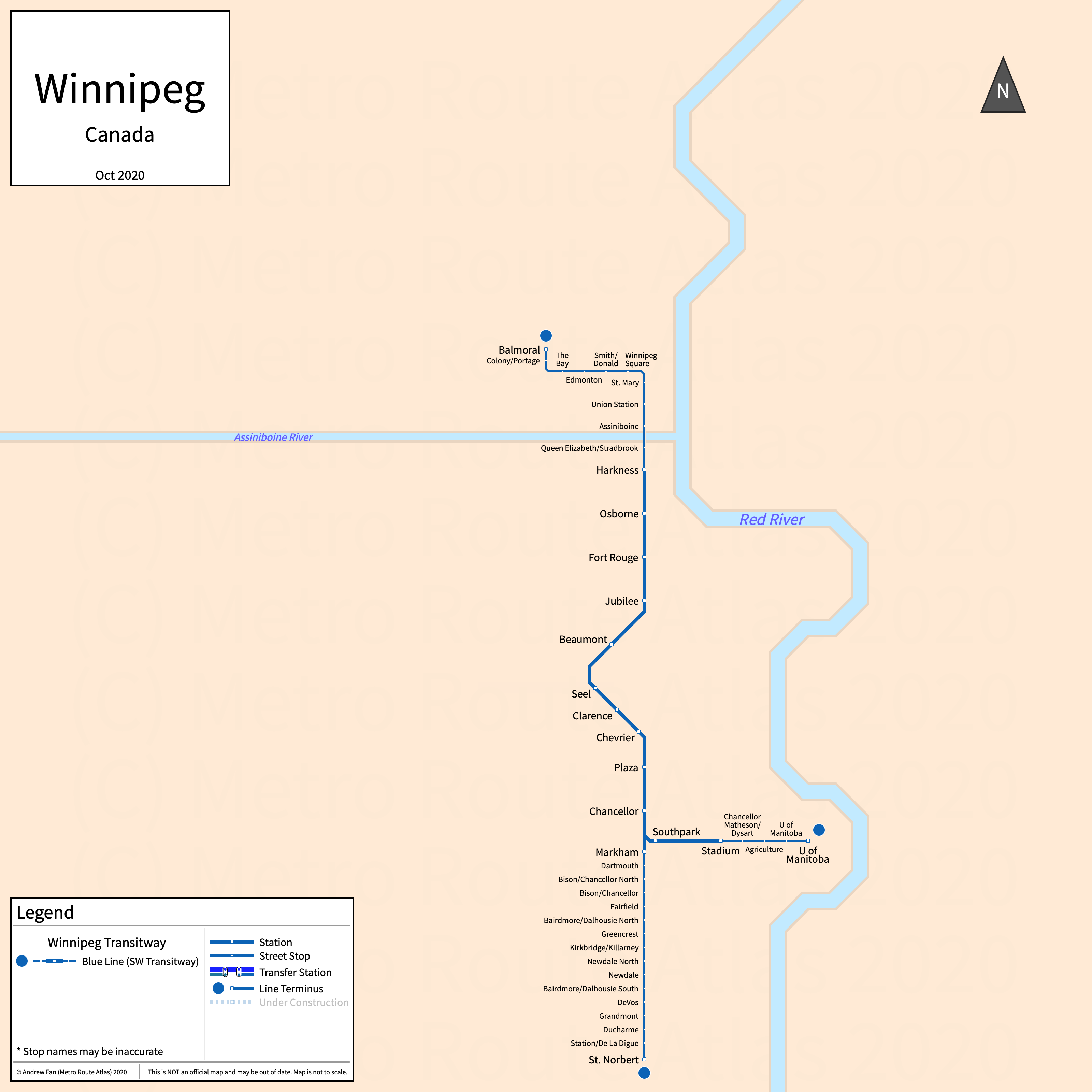
Table of Contents
Overview - Winnipeg
Located at the confluence of the Red and Assiniboine rivers, Winnipeg is the capital and the largest city by population in Manitoba. It has approximately 783,000 inhabitants in the city proper as of 2022. The Manitoba metropolitan area comprised 834,678 residents as of the Canada 2021 Census.
Winnipeg's rapid transit network consists of a single bus rapid transit line.
Winnipeg Transitways
Opened 2012, Winnipeg's transitways consist of a single bus rapid transit line that serves the city of Winnipeg, Manitoba and the surrounding suburbs.
Southwest Transitway
The Southwest Transitway is a bus rapid transit line on a North-South alignment. It runs from Harkness adjacent to downtown Winnipeg in the north to Markham and Stadium in the south, serving 13 stations. The primary service along the Southwest Transitway is the Blue Line, continuing to the west to the Unicity Hub and in the south to the University of Manitoba and St. Norbert. Only the stations on the transitway are shown on the strip map above
The Southwest Transitway was opened in April 2012 and the last extension to the line was to Stadium and Markham in April 2020. The Southwest Transitway is operated by Winnipeg Transit.
References & Helpful Links
Southwest Transitway at Wikipedia
Official Website for Blue Line: Winnipeg Transit
Maps
Official System Map - Winnipeg Transit [PDF] [Last Accessed Jun 29, 2025]
Other Sources
Winnipeg, Canada at BRTDATA.org
Asset Notes
Blue Line color taken from official system map as of October 2020.