St. Louis, Missouri, USA
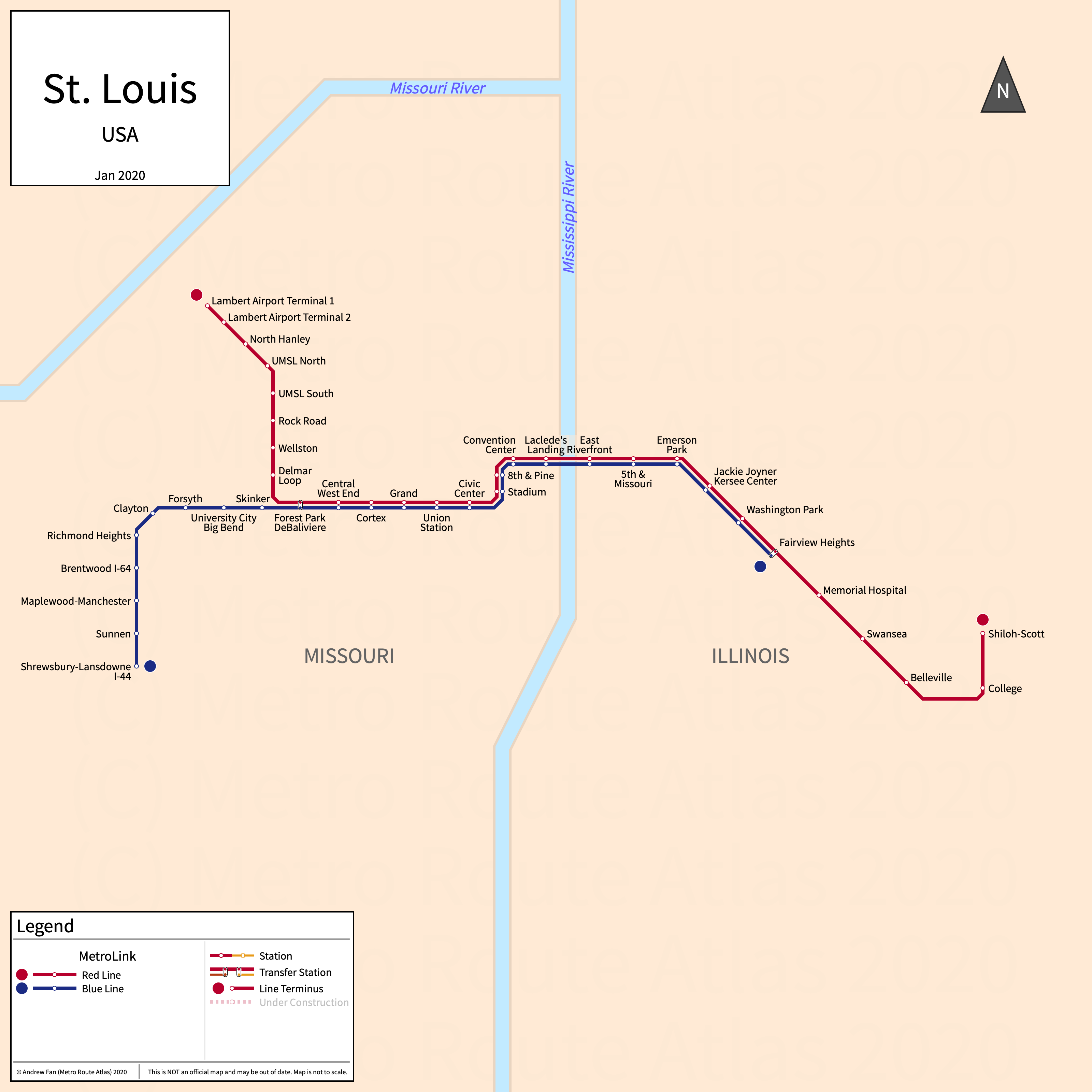
Table of Contents
Overview - St. Louis
Located on the west bank of the Mississippi River across from Illinois, St. Louis is the second largest city by population in Missouri after Kansas City. It has approximately 282,000 inhabitants in the city proper as of 2023. The St. Louis metropolitan area (St. Louis-St. Charles-Farmington) comprised 2,796,999 residents as of the 2023 US Census Bureau Estimate.
Greater St. Louis's rapid transit network consists of two light rail services.
MetroLink
Opened 1993, MetroLink consists of two light rail services that serve the city of St. Louis, Missouri and the surrounding suburbs in both Missouri and Illinois across the Mississippi River.
Red Line
The Red Line of St. Louis MetroLink is a light rail service on an East-West alignment, running from Lambert Airport in the west to Shiloh-Scott in the east, serving 29 stations. It shares its alignment with the Blue Line between Forest Park - DeBaliviere and Fairview Heights.
The Red Line was opened in July 1993 and the last extension to the line was the opening of Cortex station in July 2018. The Red Line is operated by the Bi-State Development Agency.
| Service | M-F Midday | M-F Rush | Sat. | Sun. | Notes |
|---|---|---|---|---|---|
| Red | 20' | 20' | 20' | 20' |
Schedules -- Last Updated: May 17, 2025
Blue Line
The Blue Line of St. Louis MetroLink is a light rail service on an East-West alignment, running from Shrewsbury-Lansdowne I-44 in the west to Fairview Heights in the east, serving 24 stations. It shares its alignment with the Red Line between Forest Park - DeBaliviere and Fairview Heights.
The Blue Line was opened in August 2006 and the last extension to the line was the opening of Cortex station in July 2018. The Blue Line is operated by the Bi-State Development Agency.
| Service | M-F Midday | M-F Rush | Sat. | Sun. | Notes |
|---|---|---|---|---|---|
| Blue | 20' | 20' | 20' | 20' |
Schedules -- Last Updated: May 17, 2025
References & Helpful Links
Official Website for MetroLink: MetroLink
Maps
All Official Maps - MetroLink [Last Accessed May 17, 2025]
Official System Map - MetroLink [PDF] [Last Accessed May 17, 2025]
Other Sources
St. Louis, USA at Urbanrail.net
Asset Notes
MetroLink colors taken from official January 2019 map.