Indianapolis, Indiana, USA
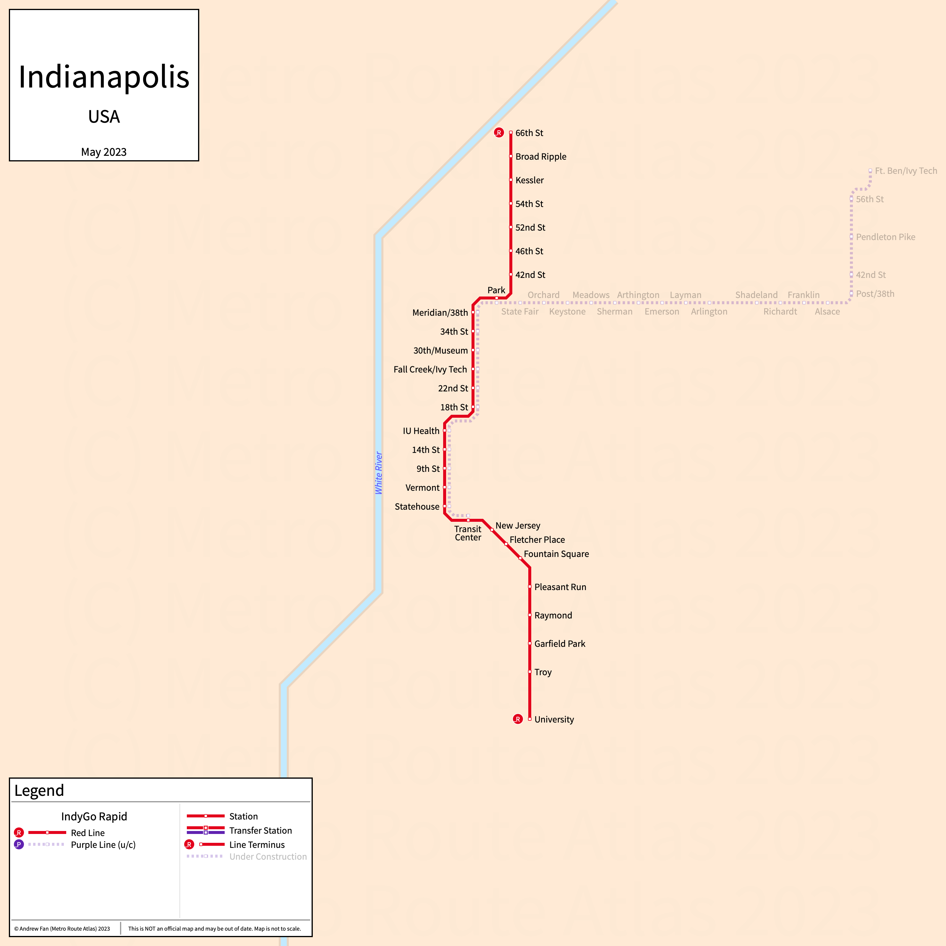
Table of Contents
Overview - Indianapolis
Located on the White River in central Indiana, Indianapolis is the capital and largest city by population in Indiana. It has approximately 879,000 inhabitants in the city proper as of 2023. The Indianapolis metropolitan area (Indianapolis-Carmel-Greenwood) comprised 2,138,468 residents as of the 2023 US Census Bureau Estimate.
Indianapolis's rapid transit network consists of two bus rapid transit services.
IndyGo Rapid
Opened 2019, IndyGo Rapid consists of two bus rapid transit services that serve the city of Indianapolis, Indiana and the surrounding suburbs.
Red Line
The IndyGo Rapid Red Line is a bus rapid transit service on a North-South alignment. It runs from 66th/College in the north to University in the south via the Julia M. Carson Transit Center in Downtown Indianapolis, serving 28 stations. It runs on dedicated bus lanes on Capitol Ave, Meridian St, and College Ave.
The Red Line was opened in September 2019. The Red Line is operated by the Indianapolis Public Transportation Corporation.
| Service | M-F Midday | M-F Rush | Sat. | Sun. | Notes |
|---|---|---|---|---|---|
| Red | 15' | 15' | 15' | 15' |
Schedules -- Last Updated: Mar 17, 2025
Purple Line
The IndyGo Rapid Purple Line is a bus rapid transit service on a Northeast-Southwest alignment. It runs from Fort Harrison in the north to the Julia M. Carson Transit Center in Downtown Indianapolis in the south, serving 31 stations. It runs on dedicated bus lanes on Capitol Ave, Meridian St, most of its route on 38th St excluding the center portion, and on most of its route on Post Rd.
The Purple Line was opened in October 2024. The Purple Line is operated by the Indianapolis Public Transportation Corporation.
| Service | M-F Midday | M-F Rush | Sat. | Sun. | Notes |
|---|---|---|---|---|---|
| Purple | 15' | 15' | 15' | 15' |
Schedules -- Last Updated: Mar 17, 2025
References & Helpful Links
Official Website for IndyGo: IndyGo
Maps
All Official Maps - IndyGo [Last Accessed Mar 17, 2025]
Other Sources
Asset Notes
The IndyGo Rapid Red Line color was taken from the line map on the IndyGo website as of June 20, 2020. At least three different shades of red are in use on the website for the line; the color may be replaced at a later time. The IndyGo Rapid Purple Line color was taken from the line map on the IndyGo website as of May 12, 2023.